
Almaty region
- All


Almaty region
Almaty region is a dynamically developing region of Semirechye, rich in recreational resources. Semirechye is rich in monuments of history, culture, nature, unique natural landscapes. Charyn canyon, rock paintings of Tamgaly Tas, monuments of eastern religion, many mounds and settlements, relic groves and picturesque landscapes. Due to the diversity of natural landscapes, the Almaty region is one of the richest in Kazakhstan in terms of tourist opportunities. We suggest you take a virtual tour of 10 places in the Almaty region, which attract tourists not only from Kazakhstan, but also from all over the world.
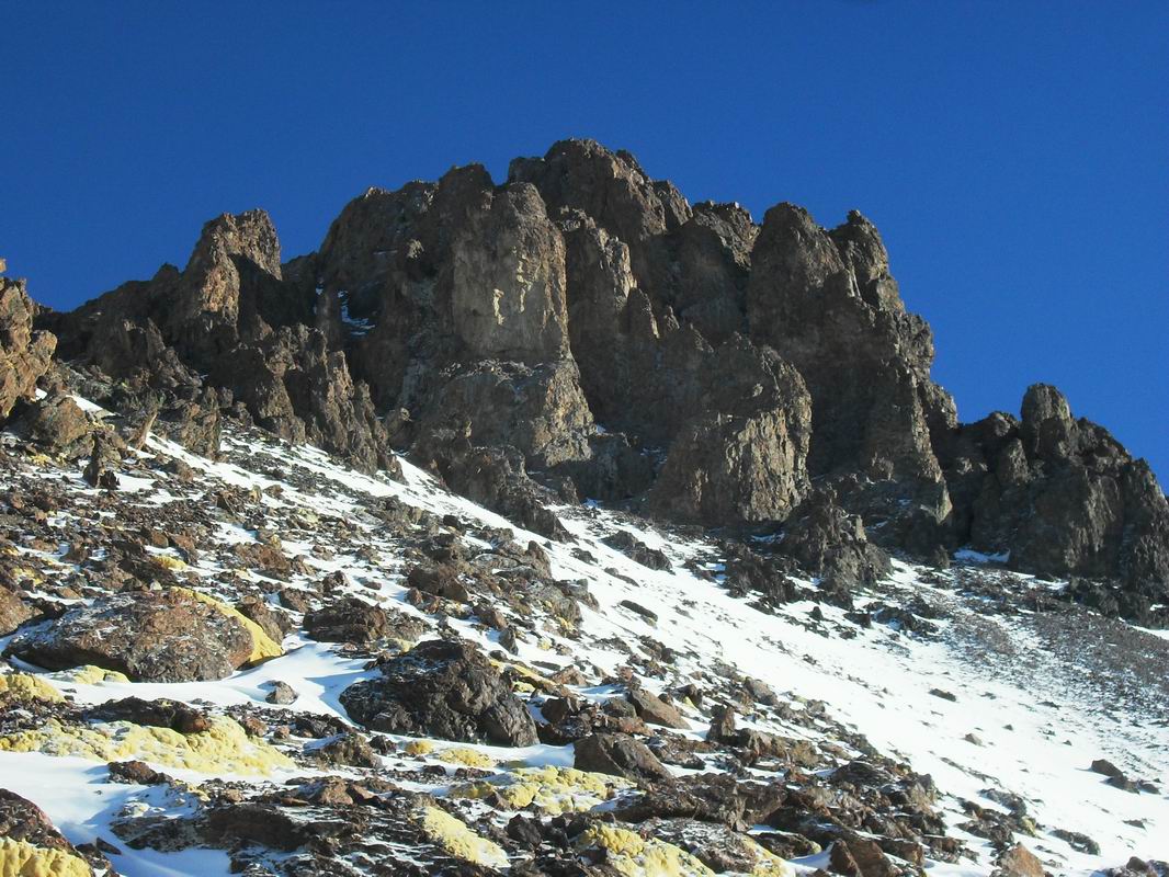
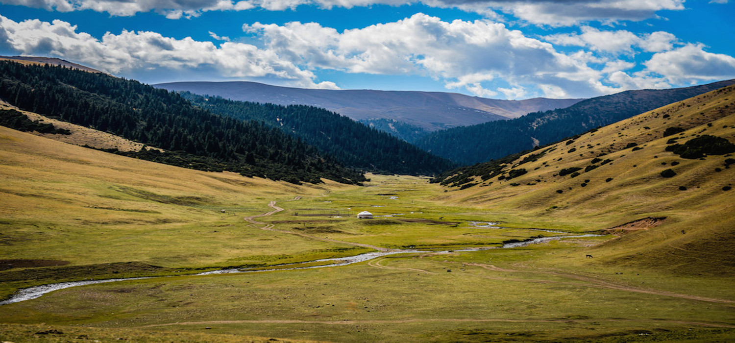
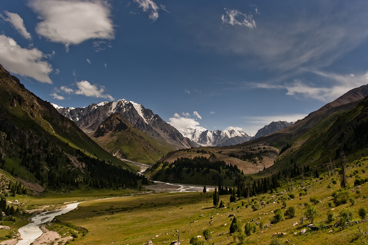
Khan – Tengri – mountain top, the Republic Kazakhstan highest point on border with Kyrgyzstan and China, on one given-6995 m., on other-7010 m. is in east part of Central Tien Shan in a ridge of Tengri-Tag. Central Tien Shan is located in Average and the Central Asia, basically in Kyrgyzstan (the western part) and China (east part), partially in Kazakhstan and Uzbekistan. Extent from the West on the east about 2500 km., from the north on the south of 300 km.
The highest points: Pobeda peak (7439м) and peak “Khan Tengri” (7010).
For Central Tien Shan landscapes of the Alpine type are characteristic: sharp crests are underlined by grey-turquoise glaciers and dazzling snowflakes; the Alpine meadows adjoins with woods Tien Shan spruce. In this area high-mountainous tourism is mainly developed.
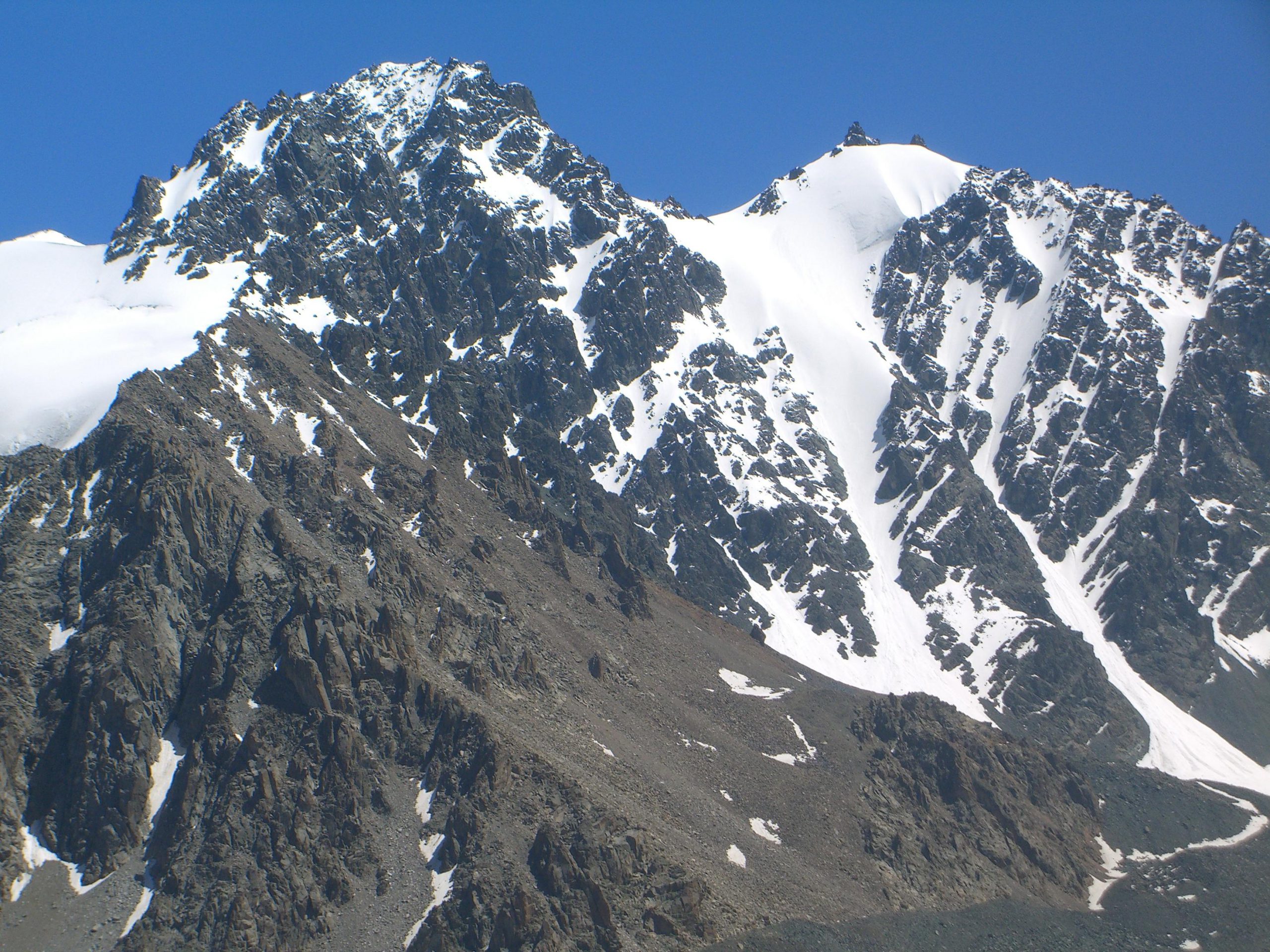
Climbing Khan – Tengri peak is the goal of many climbers around the world. More than 10 routes have been laid to the top. Most tourists get to the base camps at the foot of Khan – Tengri using a helicopter. It takes a minimum of fourteen days to reach altitude. Ascents are made all year round, but the optimal period is June-August. The area around the mountain includes many peaks at 6,000 m, including the Marble Wall (6,400 m). This is an area of alpine valleys with beautiful lakes and rivers. Under the peak is the Khan – Tengri International Mountaineering Camp (MAL), which hosts up to 2000 climbers and mountain tourists per season.
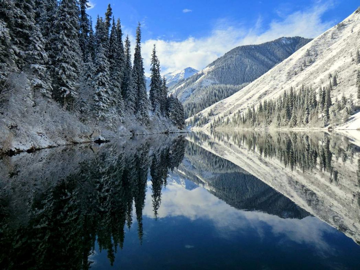
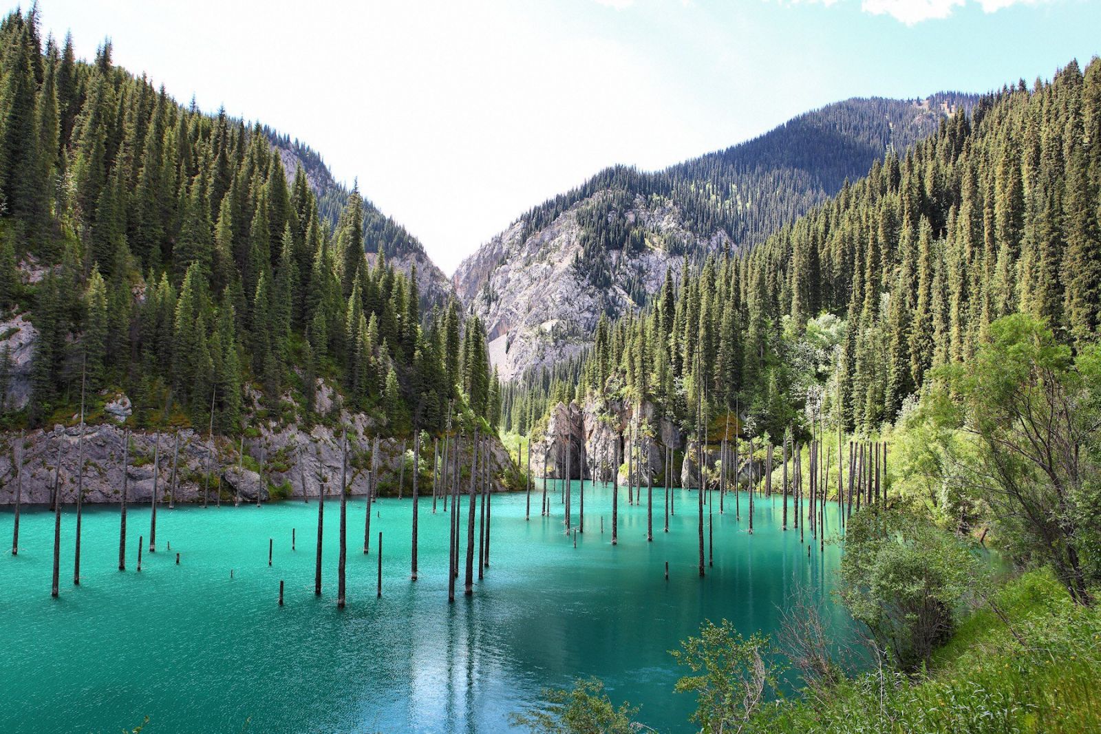
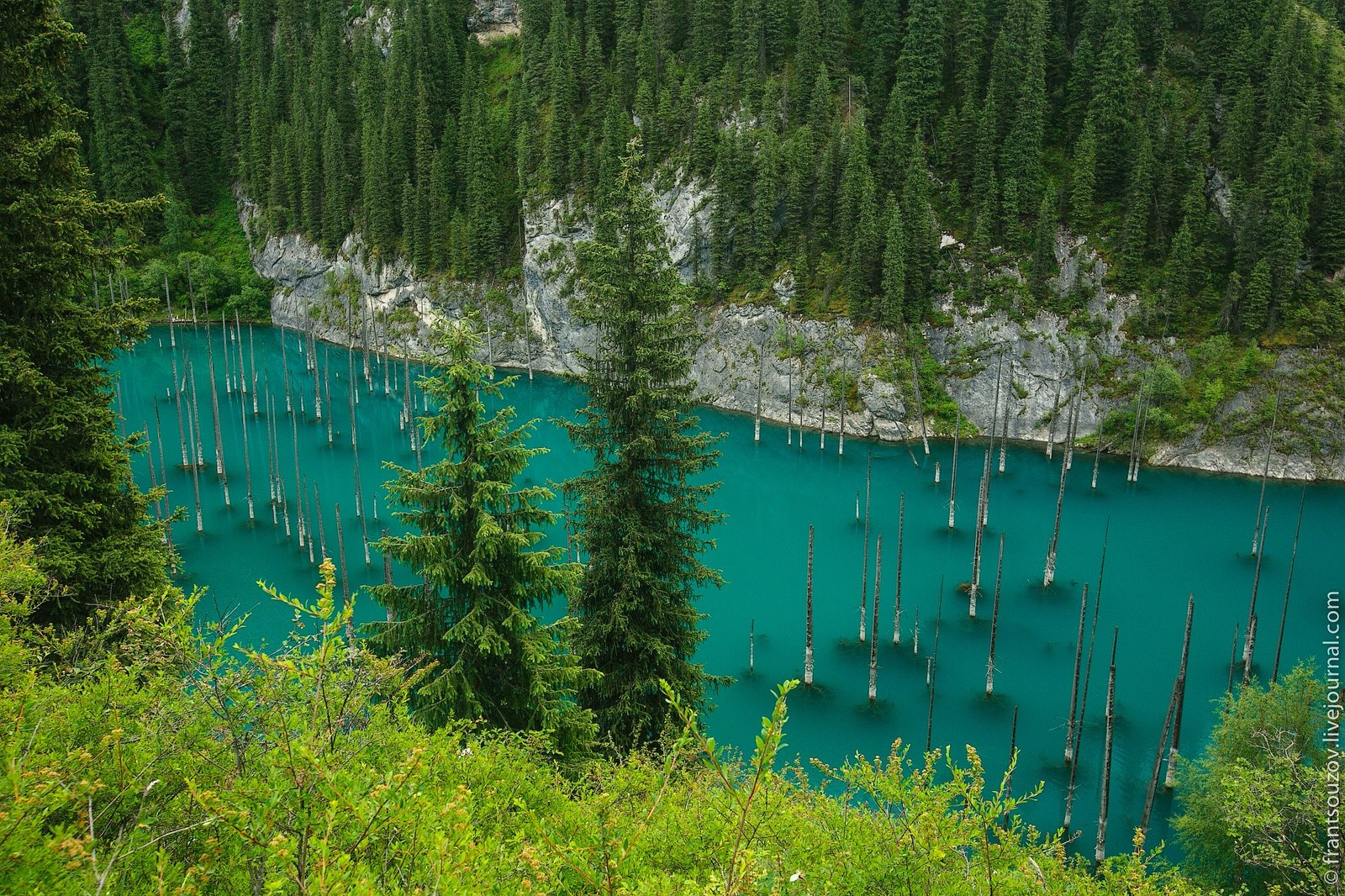
Big Almaty Lake
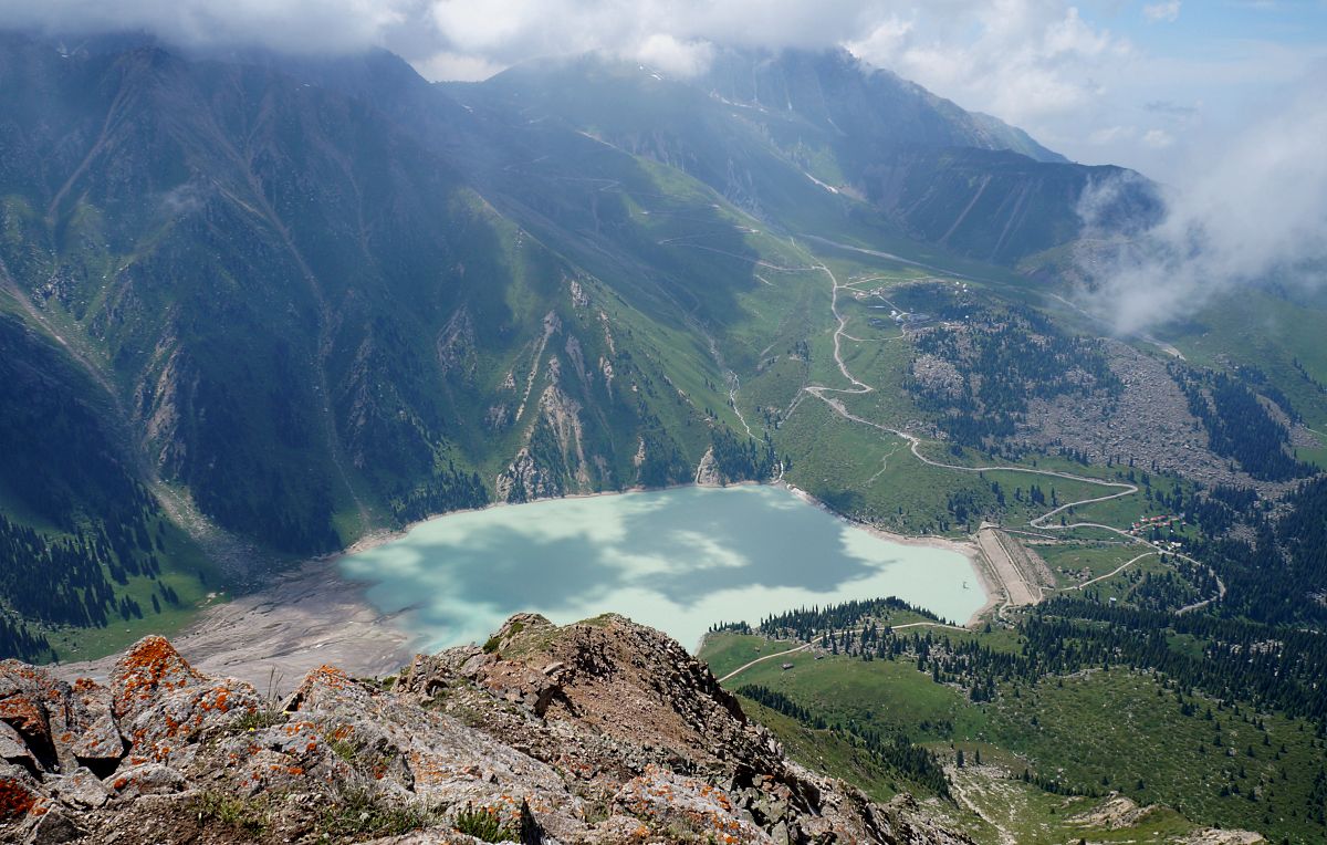
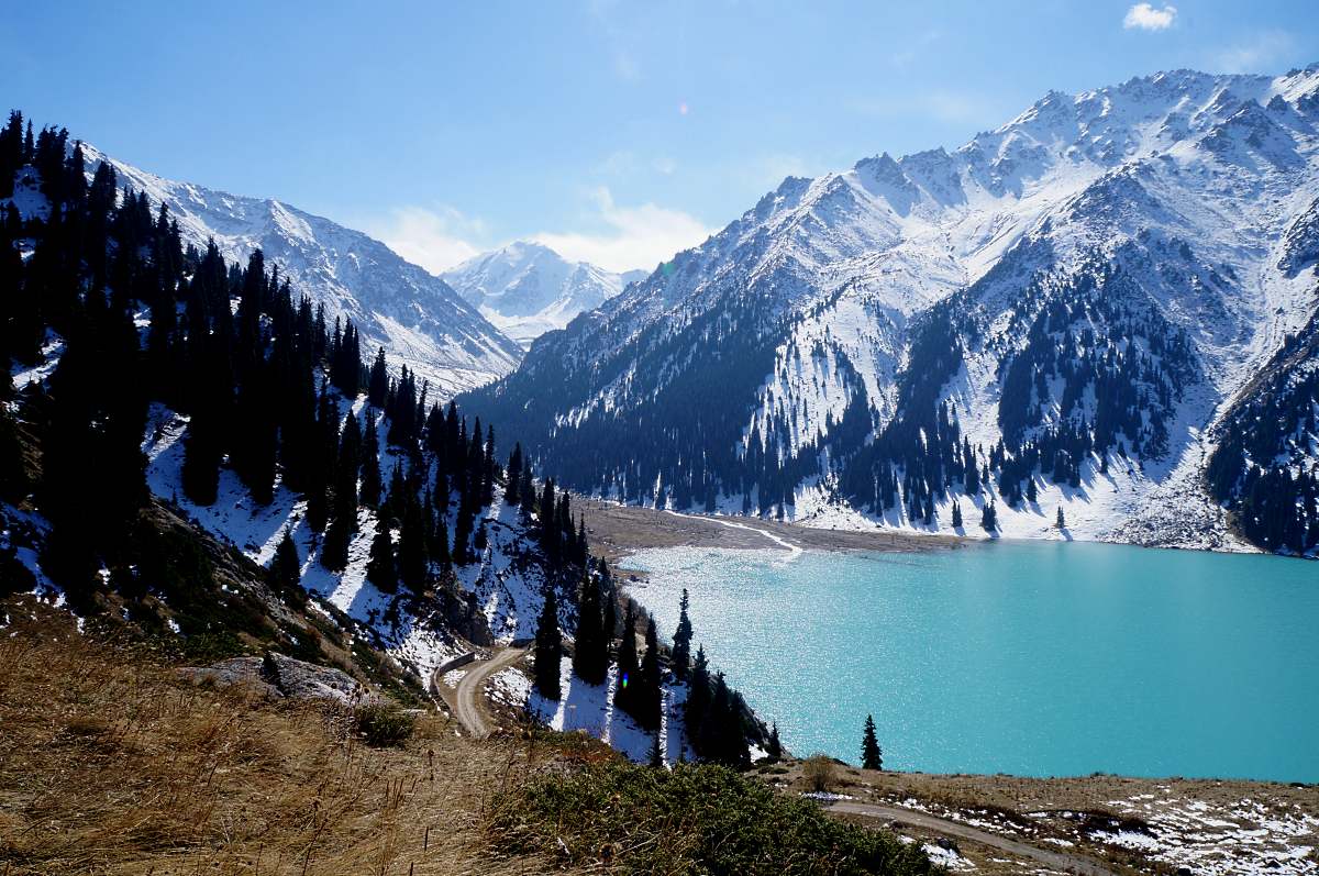
In the southern direction from Almaty, at a distance of about 30 km, at an altitude of more than 2500 meters, there is a beautiful lake surrounded on all sides by mountain peaks. Its surface shines like a mirror in a depression about 1 km long and 40 meters deep. The three highest peaks of the Tien Shan ridge rise above the lake: Peaks Tourist (3,950 m), Ozerny (4,150 m) and Soviets (4,320 m). The lake is fed by melt water from glaciers. Therefore, it has a cold water temperature that does not exceed 8 degrees Celsius throughout the year. The lack of swimmers may contribute to the preservation of the lake’s fragile ecosystem, which would undoubtedly suffer in the event of a large influx of tourists. Depending on the light and the season, the color of its surface changes from dark blue to pale green. Above the lake there is a valley, where a settlement is spread, in the center of which you can see the domes of the famous Tien Shan observatory. In the mid-50s, a cascade of hydroelectric power stations was built in the upper reaches of the Bolshaya Almatinka River. In the 80s, the height of the natural dam of the lake was increased, which prevented the danger of its possible destruction by a mudflow. At present, the waters of the Almaty Lake are the main source of drinking water for the capital of Kazakhstan, therefore it is included in the list of restricted facilities, access to which is limited. In addition, the route itself to the lake with a length of 23 km is considered quite risky due to the possibility of a mudflow. Today the lake is part of the Ile-Alatau State Reserve.
Charyn canyon
At a distance of 200 km east of Almaty, near the border with China, there is one of the most beautiful natural monuments of Kazakhstan – Charyn Canyon. It stretches for 154 km along the banks of the Charyn River. The sheer walls of the canyon, built of sedimentary rocks, reach a height of 300 meters. The unreal fantastic relief of the canyon is the result of the impact of water and wind on the rocks of the rocks for almost 12 million years. This is the age of the canyon. All this time, nature, like a sculptor, worked on all this architecture, carving the most bizarre statues and sculptures from the rocks. Weathering and erosion of rocks have created here such picturesque natural phenomena as, for example, the most picturesque “Valley of Castles”, “Witches’ Gorge” and many others. For its natural beauty, Charyn Canyon is often compared to the famous Grand Canyon in Colorado. Its relief is striking in its dismemberment. The canyon seems to be covered by a dense network of gullies and ravines randomly scattered everywhere. Along them, as if the towers of fairy-tale castles, arches and pillars are placed. Here grows the rarest representative of the earth’s Flora. This is a type of relict, so-called Sogdian ash, which survived the Ice age. There is a whole grove of these trees growing here. Another, similar to it, has been preserved on the globe only in one of the corners of North America. Since 1964, the grove has been declared a state property and is protected by law as a particularly valuable natural monument. No less interesting is the grove of the rarest Asian poplar. The diversity of the canyon’s landscapes has led to a variety of flora and fauna. On its territory grows up to one and a half thousand species of plants. Of these, 17 are included in the International Red Book. It is home to 62 species of mammals, 23 species of reptiles and 103 species of birds. At the very bottom of the canyon, a raging Charyn is raging. Here, on its banks, tourist groups usually make a stop and listen to the exciting stories of the guide. In 2004, by the decision of the Government of Kazakhstan, the Charyn Canyon, together with the surrounding territories, was included in the Charyn National Reserve.
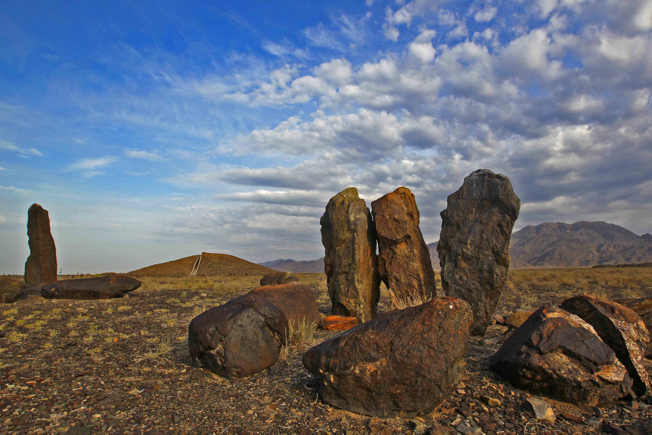
Burial mounds Besshatyr
In the Semirechye zone, in the upper reaches of the Ili River, there are huge Bes-Shatyr burial mounds, which means Five Tents. They represent a necropolis or burial ground of the ancient Sakas, a nomadic people who lived on the territory of Kazakhstan in the first millennium BC. The territory occupied by them is 2 sq. km. The total number of mounds is 18. The largest of them reaches 17 meters in height and is about 104 meters in diameter. They served as burial places for Saka leaders and generals. The mounds are located in the center of the so-called menhirs – ring-shaped megalithic structures that resemble the ancient monuments of Stonehenge in the UK. Initially, the mounds were structures of the correct geometric shape. Over the thousands of years of their existence, they have turned into swollen hills. Under each of the mounds there is a crypt built from the trunks of the Tien Shan spruce. In the western part of the necropolis, in the direction from north to south, 45 stone slabs are installed, on which images of animals are carved. Scientists believe that funeral rituals were performed in this place. They were often accompanied by the sacrifice of horses, bulls and people. After the burial of the next leader, the mound had a rather terrible look. Along the entire perimeter, killed horses were placed on supports made of poles, and killed horsemen – the chief’s servants – were planted on them. The gloomy picture was complemented by clouds of a crow eating corpses. The Ili River flows not far from the burial ground. In ancient times, there was one of the sections of the Great Silk Road along which caravans went. Today you can swim in the river and sunbathe on the beach.
Singing Dune
One of the unique natural monuments located on the right bank of the Ili River is the so-called “Singing Dune”. This unique sand formation is located between two mountains – the Small and Large Kalkans. Its length reaches 3 km, and its height is 80 meters. It has unusual properties. In the dry summer time, when a strong wind blows, the sand mountain begins to emit a powerful hum, vibrating tonality, reminiscent of the sound of an organ. This phenomenon has a simple physical explanation. Dry sand grains raised by the wind, as a result of friction with the air, become electrified and begin to vibrate. At some point, the phenomenon of resonance occurs and a sound wave is generated. It, in turn, is reflected from the compacted soil, and causes the trembling and humming of the dune. The sound generated by this process can be heard at a distance of several kilometers. An interesting fact is that the dune, consisting of shifting sand, is not, like ordinary dunes, nomadic. And despite the strong winds blowing in the area, it has remained in place for thousands of years. From the south-west side, its slope appears to be completely smooth, while from the north-east it has a number of ridges. On the slopes of the Singing Dune there are thickets of the rarest white haloxylon.
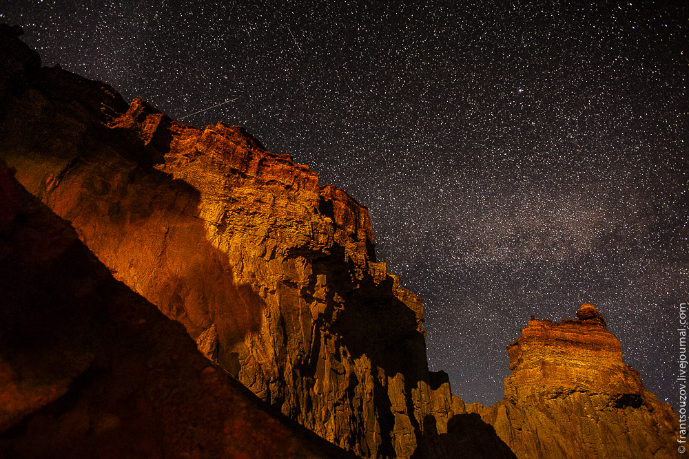
Altyn-Emel National Park
The largest National Park in Kazakhstan is “Altyn-Emel”. It is located on the western slopes of the Zhongar-Alatau mountain range. The territory of this natural reserve covers an area of more than 460 thousand hectares. Many rare and endangered species of flora and fauna found their refuge here. Among them are dozens of species of large mammals, such as desert antelopes, gazelles, Siberian mountain goats – teke, Pamir mountain rams – argali, wolves, foxes, as well as rare species of birds: mountain partridges – keklik, golden eagles, white-headed vultures, bearded birds. All of them are in the International and Kazakhstan Red Books. Several species of herons, waders, ducks and other aquatic birds live in the wetland part of the park. The Ili river and the Kapchagai reservoir flowing through the park are replete with stocks of fish, valuable species such as grass carp, pike perch, carp, bream, asp, silver carp and a number of others. In the park, you can see such an amazing natural phenomenon as the springs of the purest water gushing right from the ground and feeding whole groves of trees. Among them there are old elms, about 700 years old. They remember the warriors of Genghis Khan who watered their horses from these springs. The famous traveler and educator Shoqan Walikhanov stayed near one of the springs in 1856 during his trip to Kashgaria. Turanga and jigida, honeysuckle, willow, and Ili barberry prevail among large trees and shrubs. Black haloxylon grows in the steppe zone. There are several natural and historical monuments on the territory of the reserve. Among them it is interesting to note the Terekti-Sai gorge, on the black stones of which there are rock carvings with scenes of hunting and everyday life of ancient people dating back to the 16-14 centuries BC. In the Kyzyl-Duyz gorge there is a cave, which ancient cattle breeders used as a natural sheep yard, a picturesque waterfall falls from the rocks not far from it, and a rare “stone” tree grows here. Its wood is so hard that it defies an ax. Previously, even bullets were made from it. Another historical monument is the Scythian burial mounds of Bes-Shatyr, dating back to the 1st millennium BC. On the right bank of the Ili River, you can see another attraction of the reserve, the famous “Singing Dune”, on the slopes of which there are thickets of the rarest white haloxylon. Here you can also visit the natural museum of the distant geological past of the Earth. These are the chalk mountains of Aktau or White Mountains in translation. 15 million years ago, an ancient sea raged in their place. Now this is reminded of the bizarre layers of sedimentary rocks of the most unusual shapes and shades of color – from red and blue to white and yellow. The mountains themselves are conical in shape and resemble the pyramids of Egypt. At their foot and on the slopes, paleontologists have discovered the bones of fossil lizards and mammals. The final part of the trip to the reserve is the Katutau mountains. Once upon a time, volcanoes raged in their place. The frozen lava flows, processed over millions of years by winds, rains, frost and sun, took the form of amazing statues. Several modern-level tourist facilities have been built on the territory of the park: 4 hotels, a tent camp, hunting lodges, and gazebos for recreation are installed on all routes. To explore the reserve, you can book excursions on horses, camels or cross-country vehicles.